The research team carries out specific activities regarding the use of GIS tools, remote sensing, photogrammetry and digital cartography in the field of forestry.
Organization

Apostol Bogdan
Senior researcher I, Responsible Research Team (E7)
Areas of interest: assessment of forest resources using remote sensing with passive and active sensors, UAV systems
Activity
The main objective of the research team is to implement techniques and technologies for the collection, processing and exploitation of data and information from the land surface (geospatial data/information) in forestry research and practice. At the same time, the team pursues the development of methodologies specific to forest geomatics in order to promote their use in forestry.
Objectives – Research Directions
- integrated use of data and information obtained through active and passive remote sensing techniques for the assessment of structural and functional parameters of forest ecosystems;
- the assessment by means of remote sensing of the vulnerability, impact and risk of forest fires;
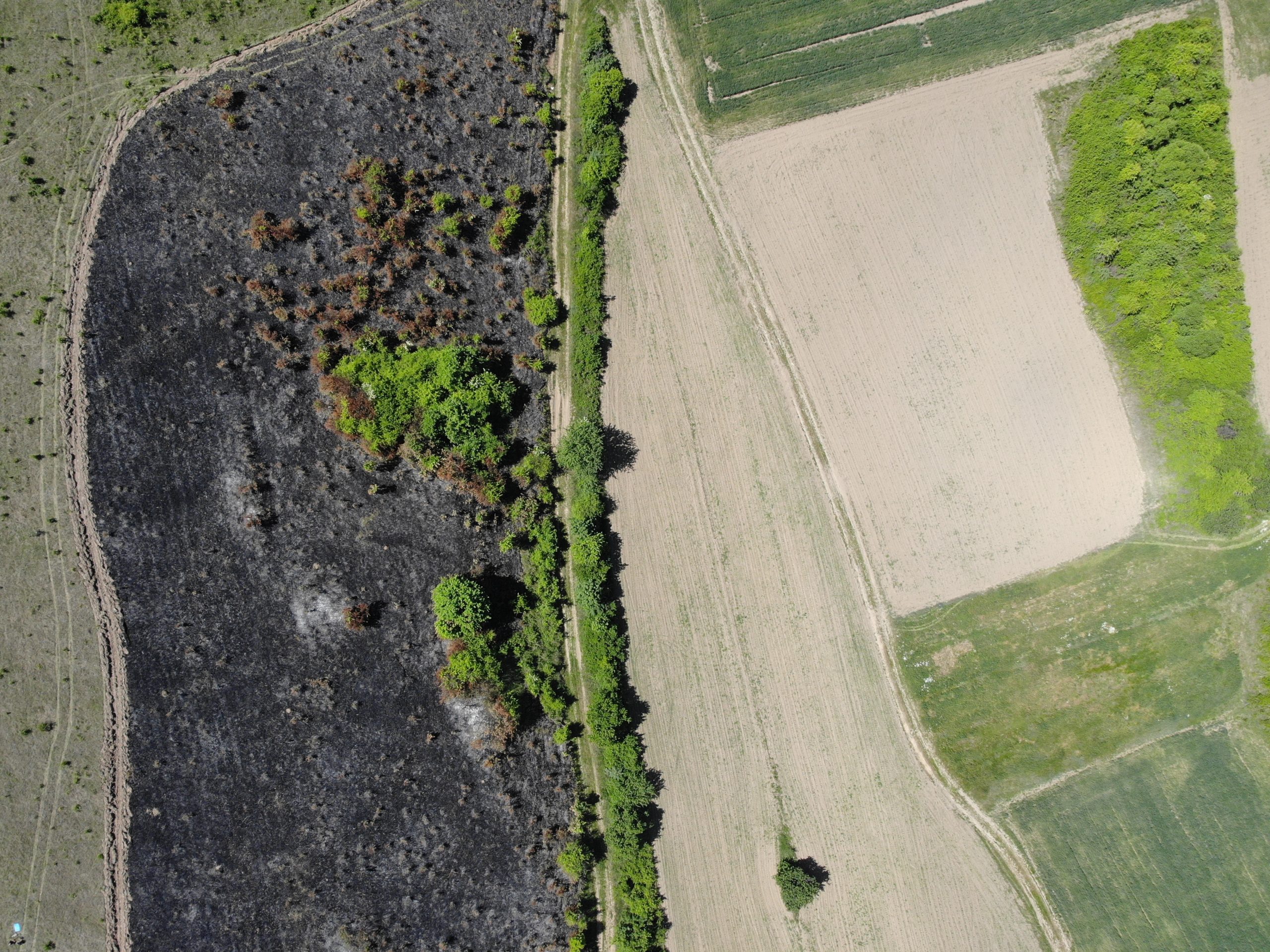
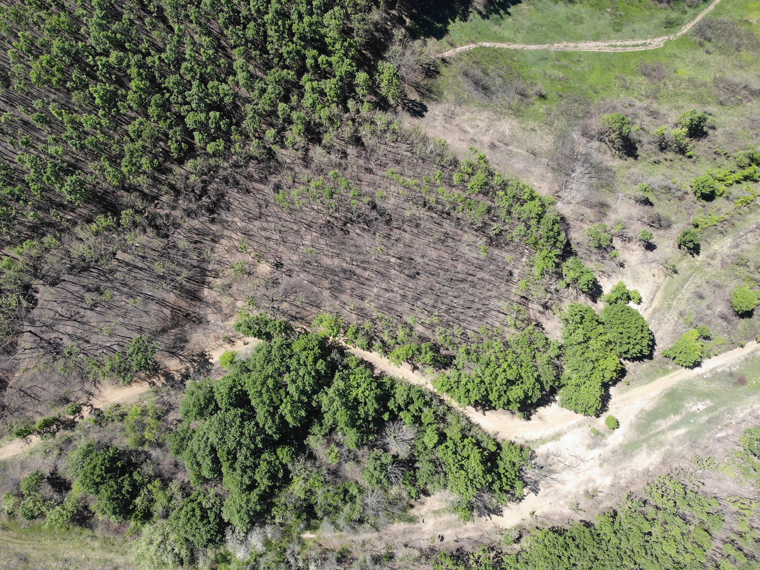
- the use of satellite and aerial images obtained with the help of drones to assess the severity of forest fires;
- creation of spatial databases for the efficiency of the management of the forest stock;
- exploitation of spatial databases through GIS analyses, digital maps, creation and exploitation of DTM digital terrain models;
- interpretation and analysis of standard products derived from existing satellite data;
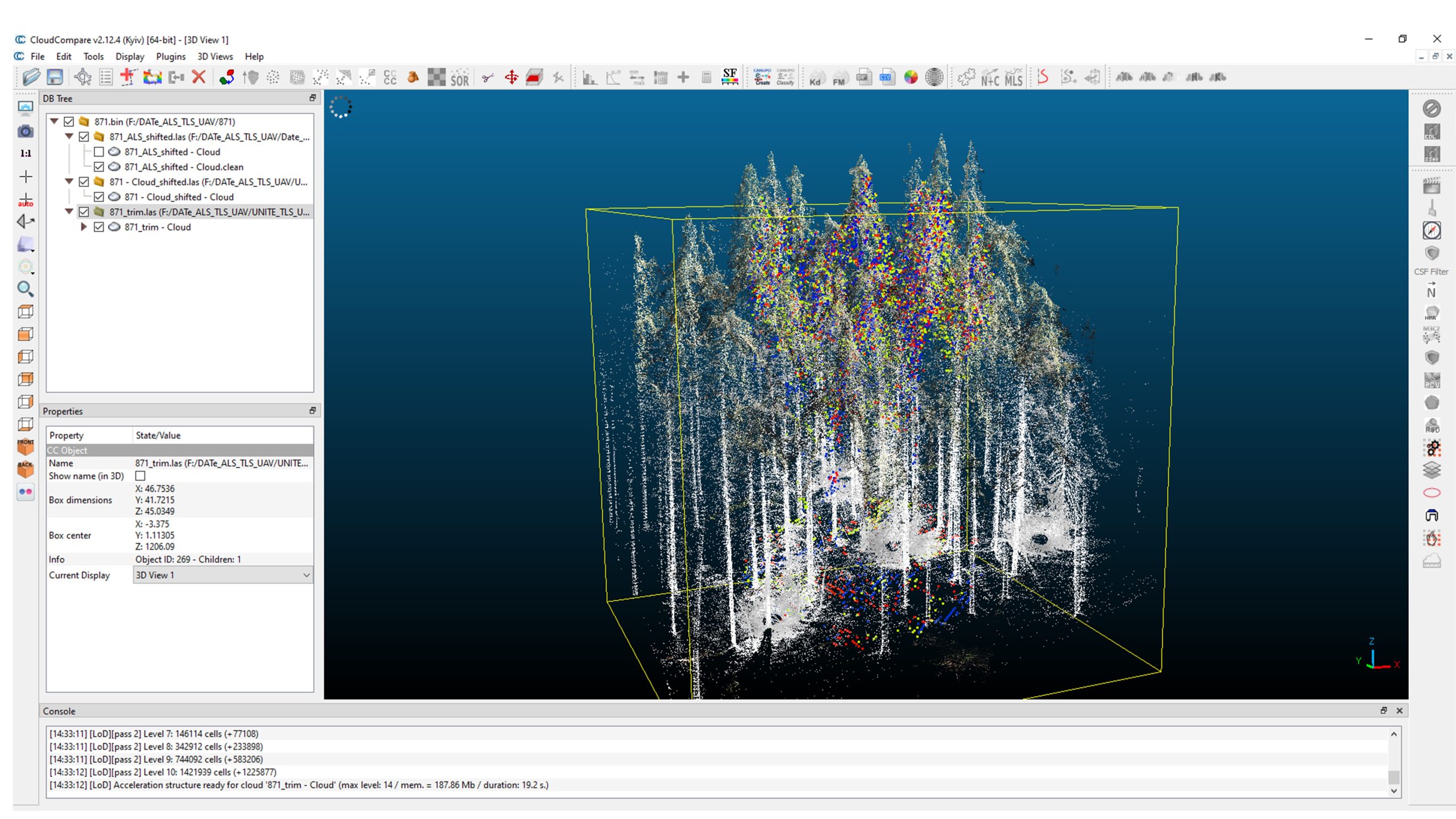
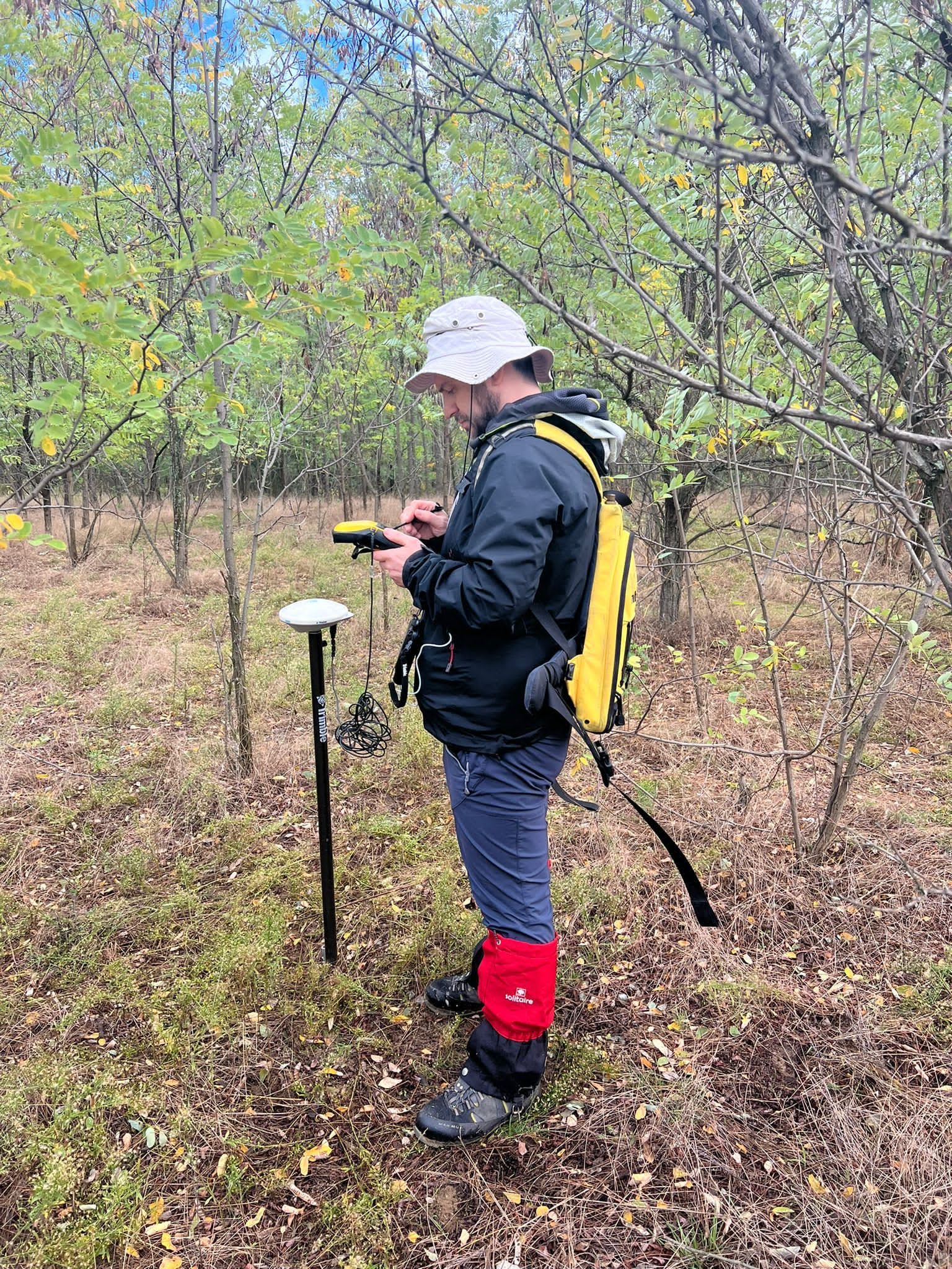
- processing, analysis and interpretation of satellite images for various purposes; control and validation by field measurements with laser devices and GNSS systems;
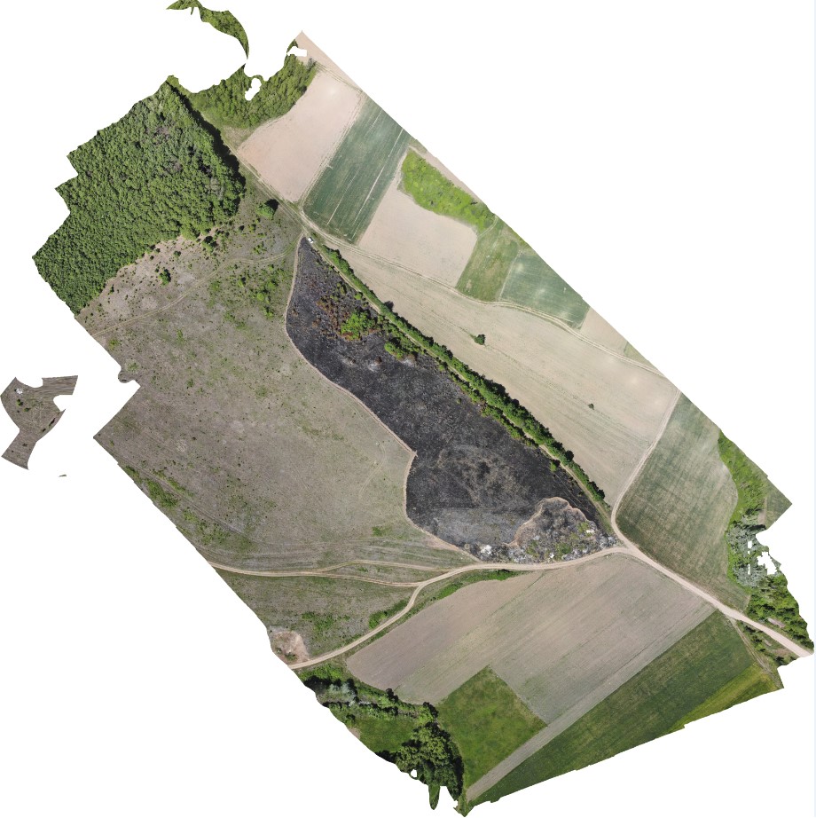
- creating orthophoto plans based on aerial or satellite images of high spatial resolution to update existing information on topographic plans;
- digital satellite photogrammetry applications;
- integration of remote sensing data with vector databases for forestry purposes and beyond.
Within the E7 research team, 1 Senior researcher, 2 Junior researcher, 1 Researchers , 1 Researchers trainee, 2 Technological development engineers, 1 Technological development engineer II, 7 Technological development engineers III and, respectively, 8 employees work as auxiliary staff.
Research infrastructure and services
Research infrastructure
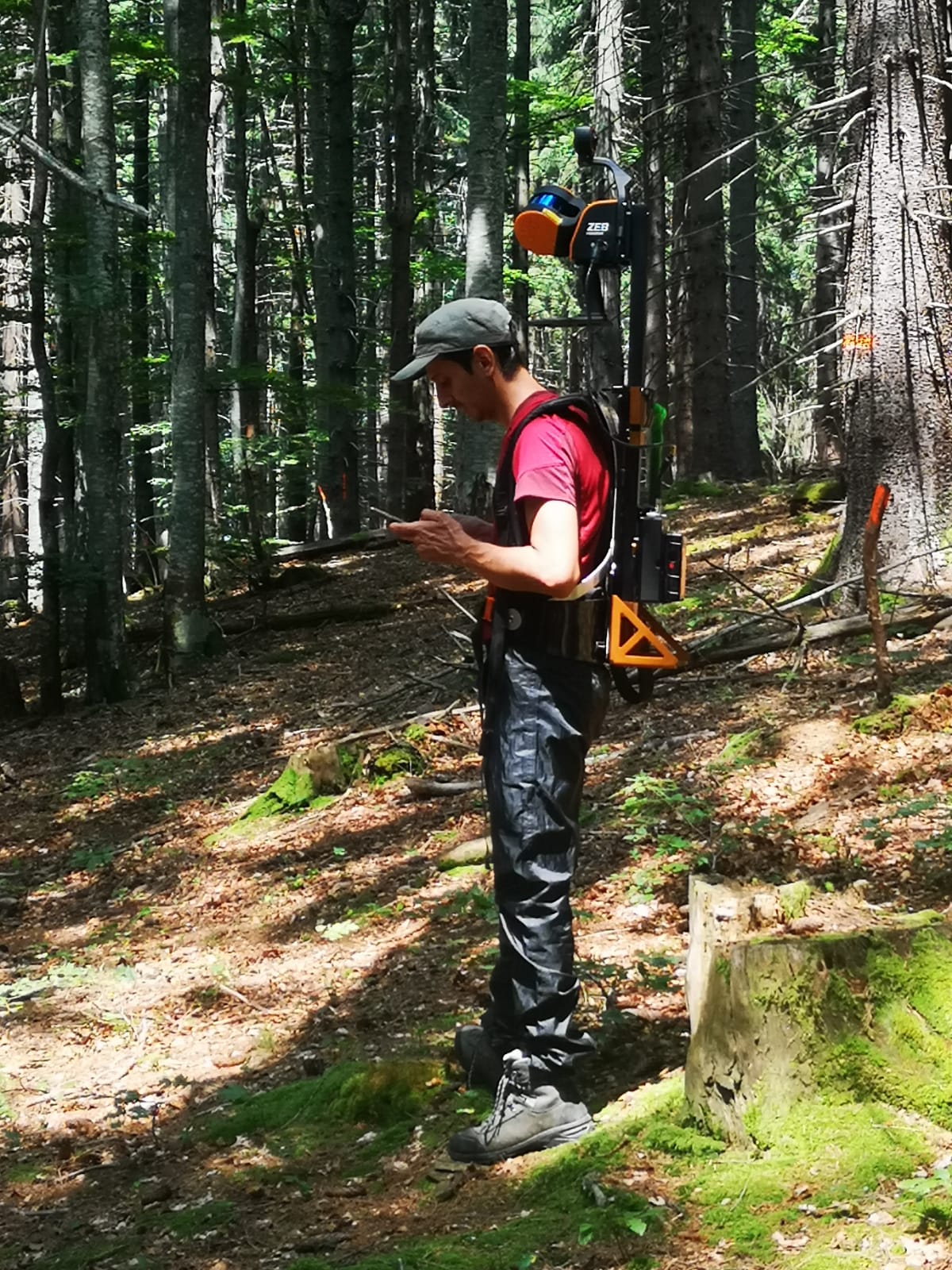
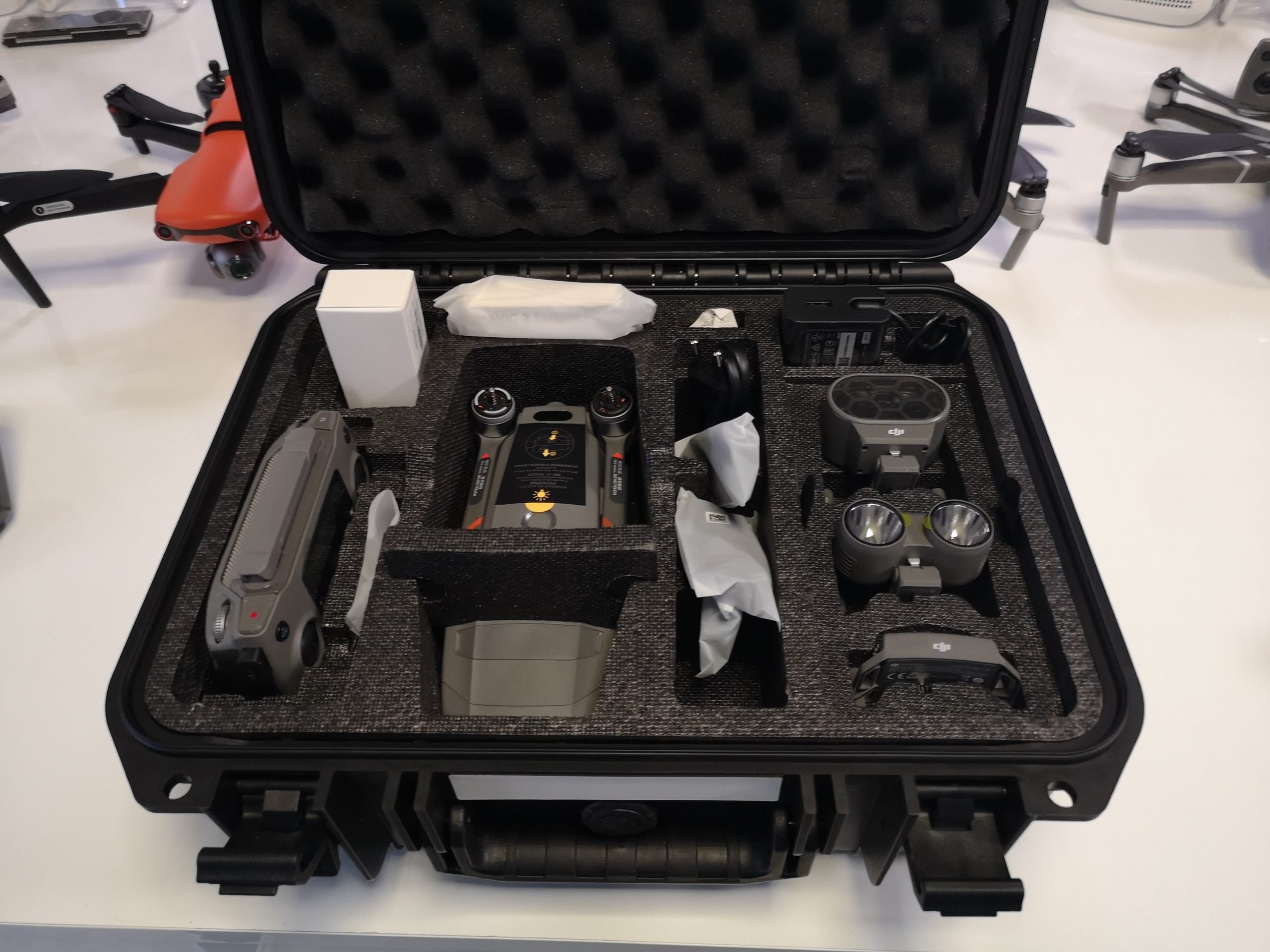
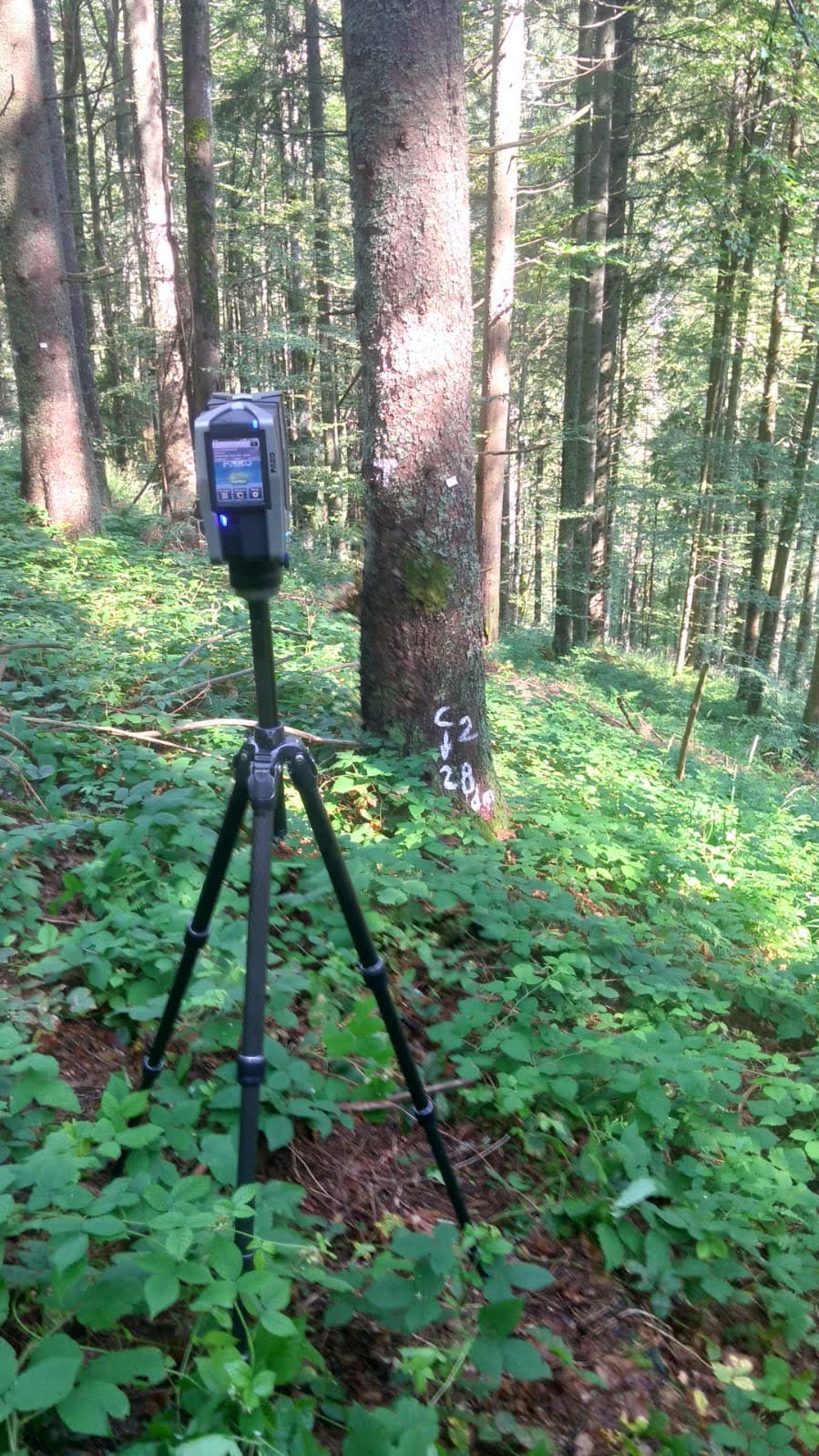
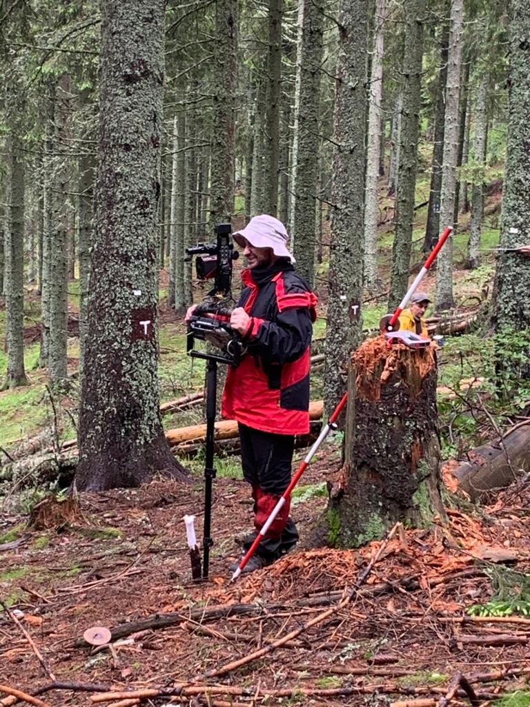
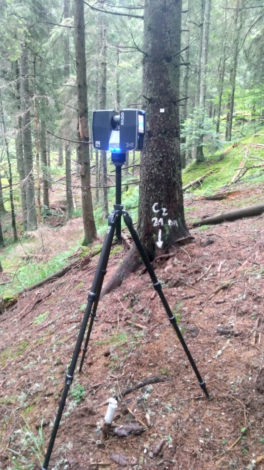
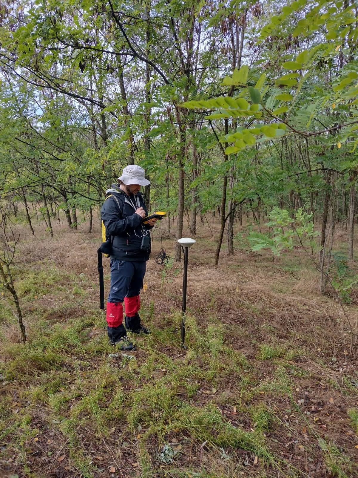
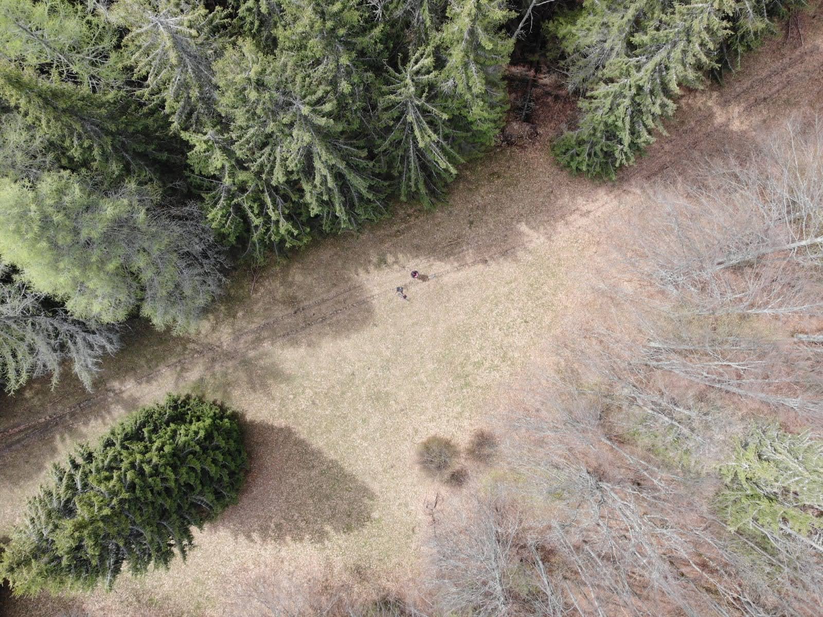
- Complex and integrated equipment for the collection of geospatial information at the stand level regarding dendrometric characteristics of trees specific to the forest inventory (FieldMap) and stationary terrestrial laser scanning (TLS), for establishing the composition of stands and assessing the damage caused by natural disasters (forest fires, felling of wind) through the use of UAVs
Research services
- Evaluation of the horizontal and vertical structure of stands by using the specific techniques of forest geomatics;
- Creation of geospatial databases on forest resources, ecosystem services provided by the forest, basic genetic materials, protected natural areas, damage caused by natural disasters (forest fires, windfalls, etc.), intensity of atmospheric pollution, areas affected by attacks from insects or desertification;
- Creation of thematic maps in digital format and orthophotoplans specific to the solutions proposed for capitalization for the management of forests through their management plans;
- Assessment of damage caused by natural disasters (forest fires, wind gusts) using images based on UAV systems – support in intervention activities.
Relevant projects
- Scientific foundations for a digital forestry through the integration of geospatial solutions and technologies (PN23090204), FORCLIMSOC Core Program, Ctr. 12N/2023 (2023-2026)
- FIREURISK – DEVELOPING A HOLISTIC, RISK-WISE STRATEGY FOR EUROPEAN WILDFIRE MANAGEMENT, Horizon 2020 Program, theme LC-CLA-15-2020, Grant Agreement no. 101003890 (2021-2025)
- The application of remote sensing techniques for an integrated management of forest ecosystems (PN 19070109), BioSERV Nucleu Program, Ctr. 12N/2019 (2019-2022)
- Development of methods for estimating and mitigating the effects of fires in Romanian forests, based on geospatial technologies – PN 19070108 – BioSERV Core Program, Ctr. 12N/2019. (2019-2022)
- Service contract for the public procurement of digital map creation services, contract no. 405/20.12.2019 (2019)
- The implementation and development of common systems and standards to optimize decision-making processes in the field of water and forests, the application of the system of evidence-based policies in the Ministry of Water and Forests for the systematization and simplification of legislation in the field of water and the implementation of simplified procedures to reduce the administrative burden for the environment forestry business (Procedure 8 – Defense of forests against fires). SIPOCA 395, MySMIS code 116297, Ctr. funding no. 202/26.07.2018. POCA Program Procedure 8 – Defense of forests against fires (2018-2021)
- The improvement of forest resource assessment methods using satellite images, image capture systems with the help of unmanned aerial vehicles and airborne and terrestrial laser scanning (PN18040102), Nucleu GENERESERV Program, Ctr. 26N/2018 (2018)
- Development of methods for assessing the hazard and risk of forest fires based on geospatial technologies (PN 18040104), Nucleu GENERESERV Program, Ctr. 26N/2018 (2018)
- Realization of the geospatial database of OS Sfânta Maria, development of development maps and the use of remote sensing images and geospatial analysis to extract information and data of forestry interest necessary for the effective management of the Sfânta Maria Forest Bypass” (Subsidiary contract: 1/03.01.2018 of of financing contract No. 15/01.09.2016 – “Increasing the economic competitiveness of the forestry sector and the quality of life through the transfer of knowledge, hnology and CDI competences (CRESFORLIFE – POC)” (2018-2020)
- Methods of identifying stands by large groups of species and determining biometric parameters of trees and stands by using modern techniques of remote sensing and geospatial data analysis (PN16330107), Nucleu DESFOR Program, Ctr. 32N/2016 (2016-2017)
- Romanian Cluster for Earth Observation RO-CEO financed by the Ministry of Research and Innovation through the Romanian Space Agency STAR program, Contract no. 109/ 07.11.2016 (2016-2019)
- ASSESSMENT OF DISASTER RISKS AT THE NATIONAL LEVEL (RO-RISK) partnership with the GENERAL INSPECTOR FOR EMERGENCIES as a partnership leader financed within the Administrative Capacity Operational Program (POCA) 2014-2020 through financing contract no. 3/17.03.2016 , cod SIPOCA 30 (2016)
- The service for carrying out the scientific studies necessary for the realization of the “Integrated Management of the sites ROSCI0085 Frumoasa and ROSPA0043 Frumoasa” (2014-2015)
Recent publications
ISI publications
- PLEȘCA, B. I., APOSTOL, B., PLEȘCA, I. M., DINCĂ, L. C., & BREABĂN, I. G., 2022. The stational and potential favorability of forest habitats for plant and animal species located in ROSCI0076 Dealul Mare-Hârlău. In Present Environment and Sustainable Development (pp. 66-66), DOI: 10.47743/pesd2022161019, WOS: 000830390400017
- CHIVULESCU, Ș., PITAR, D., APOSTOL, B., LECA, Ș., BADEA, O., 2022. Importance of Dead Wood in Virgin Forest Ecosystem Functioning in Southern Carpathians. Forests, 13, 409. DOI: 10.3390/f13030409, WOS:000775421400001
- CIUVĂȚ, A. L., ABRUDAN, I. V., CIUVĂȚ, C. G., MARCU, C., LORENȚ, A., DINCĂ, L., & SZILARD, B., 2022. Black Locust (Robinia pseudoacacia L.) in Romanian Forestry. Diversity, 14(10), 780., 2: 10.3390/d14100780
- TANASE, M. A., BORLAF-MENA, I., SANTORO, M., APONTE, C., MARIN, G., APOSTOL, B., BADEA, O. 2021. Growing Stock Volume Retrieval from Single and Multi-Frequency Radar Backscatter. Forests, 12(7), 944, DOI: 10.3390/f12070944, WOS:000676406900001
- TANASE, M., BORLAF, I., PASCU, I., PITAR, D., APOSTOL, B., PETRILA, M., CHIVULESCU, S., LECA, S., PITAR, D., CICEU, A., DOBRE, A., POPESCU, F., BADEA, O., APONTE, C., 2020. Sentinel-1/2 Time Series for Selective Logging Monitoring in Temperate Forests. IGARSS 2020 – 2020 IEEE INTERNATIONAL GEOSCIENCE AND REMOTE SENSING SYMPOSIUM, art. no. 9323952, pp. 2902-2905, DOI: 10.1109/IGARSS39084.2020.9323952, WOS:000664335302227
- CHIVULESCU S, CICEU A, LECA S, APOSTOL B, POPESCU O, BADEA O ,2020. Development phases and structural characteristics of the Penteleu-Viforâta virgin forest in the Curvature Carpathians. iForest 13: 389-395. – DOI: 10.3832/ifor3094-013 [online2020-09-01], WOS:000572884300001
- APOSTOL, B., PETRILA, M., LORENŢ, A., CICEU, A., GANCZ, V., BADEA, O., 2020. Species discrimination and individual tree detection for predicting main dendrometric characteristics in mixed temperate forests by use of airborne laser scanning and ultra-high-resolution imagery, Science of The Total Environment, Volume 698, 2020, 134074:1-17, ISSN 0048-9697, DOI: 10.1016/j.scitotenv.2019.134074, WOS:000500580700013
- TANASE,M.A., VILLARD, L., PITAR, D., APOSTOL, B., PETRILA, M., CHIVULESCU, S., LECA, S., BORLAF-MENA, I., PASCU, I.S., DOBRE, A.C., PITAR, D., GUIMAN, G., LORENT, A., ANGHELUS, C., CICEU, A., NEDEA, G., STANCULEANU, R., POPESCU, F., APONTE, C., BADEA, O., 2019. Synthetic aperture radar sensitivity to forest changes: A simulations-based study for the Romanian forests, Science of The Total Environment, Volume 689: 1104-1114, ISSN 0048-9697, DOI: 10.1016/j.scitotenv.2019.06.494, WOS:000482379400107
- MALLINIS, G., PETRILA, M., MITSOPOULOS, I., LORENȚ, A., NEAGU, Ş., APOSTOL, B., GANCZ, V., POPA, I., GOLDAMMER, J. G. ,2019. Geospatial Patterns and Drivers of Forest Fire Occurrence in Romania. Applied Spatial Analysis and Policy, 12, 773–795, on-line: 22 august 2018, DOI: 10.1007/s12061-018-9269-3 WOS:000501905800002
- APOSTOL, B., CHIVULESCU, S., CICEU, A., PETRILA, M., PASCU, I., APOSTOL, E., LECA, S., LORENT, A., TANASE, M., BADEA, O. 2018. Data collection methods for forest inventory: a comparison between an integrated conventional equipment and terrestrial laser scanning. Annals of Forest Research 61(2), p. 189-202, DOI:10.15287/afr.2018.1189, WOS:000456193900006
- APOSTOL, E.N., CURTU, A.L., DAIA, L.M., APOSTOL, B., DINU, C.G., ŞOFLETEA, N., 2017. Leaf morphological variability and intraspecific taxonomic units for pedunculate oak and grayish oak (genus L., series Schwz.) in Southern Carpathian Region (Romania). Science of The Total Environment, Volume 609: 497-505, ISSN 0048-9697, DOI: 10.1016/j.scitotenv.2017.05.274, WOS:000410352900054
- TÓTH, G., ANTOFIE, T.-E., JONES, A., APOSTOL, B., 2016. The LUCAS 2012 topsoil survey and derived cropland and grassland soil properties of Bulgaria and Romania. Environmental Engineering and Management Journal, vol 15, no. 12: 2651-2662, WOS:000393476600011
- APOSTOL, B., LORENŢ, A., PETRILA, M., GANCZ, V., BADEA, O., 2016. Height Extraction and Stand Volume Estimation Based on Fusion Airborne LiDAR Data and Terrestrial Measurements for a Norway Spruce (Picea abies (L.) Karst.) Test Site in Romania. Notulae Botanicae Horti Agrobotanici Cluj-Napoca 44(1): 313-323, DOI: 10.15835/nbha44110155, WOS:000378173900045
- BORRELLI, P., PANAGOS, P., LANGHAMMER, J., APOSTOL, B., SCHÜTT, B., 2016. Assessment of the cover changes and the soil loss potential in European forestland: First approach to derive indicators to capture the ecological impacts on soil-related forest ecosystems. Ecological Indicators 60: 1208-1220, DOI: 10.1016/j.ecolind.2015.08.053, WOS:000367407000121
BDI publications
- CAPALB, F., APOSTOL, B., CHIVULESCU, S., PETRILA, M, MARCU, C., LORENȚ, A., BADEA, O., 2022. Determinarea înălțimilor arborilor prin intermediul unui model nelinear de predicție, aplicabil arboretelor de molid din vestul Carpaților Meridionali. Revista de Silvicultură şi Cinegetică, anul XXVII, nr. 51: 56-61.
- APOSTOL, B., CAPALB, F., LORENȚ, A., PETRILA, M., CHIVULESCU, Ș., MARCU, C., FARCAȘ, S., GANCZ, V., 2021. Estimarea compoziției arboretelor prin identificarea grupelor principale de specii forestiere utilizând imagini satelitare Sentinel 2 – un studiu de caz (Use of Sentinel 2 satellite imagery for the identification of main groups of forest species – a case study). Revista de Silvicultură şi Cinegetică, anul XXVI, nr. 48: 48-57, indexare în baze de date internaționale (BDI): CABI.
- IVAN, R., PLEȘCA, M.I., LORENȚ, A., BACIU, G.E., PLEȘCA, B., APOSTOL, E.N., ACHIM, G., BUDEANU, M., 2020. Premise pentru înființarea unui plantaj de stejar pufos. Revista de Silvicultură și Cinegetică. Year XXV, No. 47/2020, 25-31.
- CAZACU, R., BACIU, G., CHIVULESCU, Ș., PITAR, D., DOBRE, A.C., APOSTOL, B., VERGHELEȚ, M., LECA, Ș., GARCIA DURO, J., LORENȚ, A., VEZEANU, C., CICEU, A., PASCU, I.S., MARCU, C., ANGHELUȘ, C., BAN, I., LOGHIN, C., BORDEA, I., KURTA, A., APOSTOL, E., BADEA O., 2020. Identifying and selecting methods for ecosystem services valuation – A case study in Piatra Craiului National Park. Revista de Silvicultură şi Cinegetică, anul XXV, nr. 47: 49-55, indexare în baze de date internaționale (BDI): CABI.
- PASCU, I.S., DOBRE, A.L., ZAMFIRA, V., APOSTOL, E., LECA, Ș., PITAR, D., APOSTOL, B., CHIVULESCU, Ș., CICEU, A., DURO, J.G., BADEA, O., 2020. Phenological analysis through the use of multitemporal TLS observations. Revista de Silvicultură şi Cinegetică, anul XXV, nr. 46 : 38-45, indexare în baze de date internaționale (BDI): CABI.
- CICEU, A., DURO, J.G., APONTE C., PASCU, I.S., DOBRE, A.L., ZAMFIRA, V., LECA, Ș., PITAR, D., APOSTOL, B, APOSTOL,.EN., CHIVULESCU, Ș., BADEA, O., 2020. Integrarea modelului de simulare Landis-II în gospodărirea pădurilor din România. Revista de Silvicultură şi Cinegetică, anul XXV, nr. 46 : 47-55, indexare în baze de date internaționale (BDI): CABI.
- CHIVULESCU, S., LECA, S., CICEU, A., PITAR, D., APOSTOL, B., 2019. PREDICTORS OF WOOD QUALITY OF TREES IN PRIMARY FORESTS IN THE SOUTHERN CARPATHIANS. Poljoprivreda i Sumarstvo (Agriculture and Forestry), Vol. 65 (4): 101-113, DOI: 10.17707/AgricultForest.65.4.09, indexare în baze de date internaționale (BDI): DOAJ, EBSCO, SCOPUS.
- LORENŢ A., NEAGU Ș., PETRILA M., APOSTOL B., GANCZ V., MITSOPOULOS I., MALLINIS G., 2018. Evaluarea hazardului la incendii de pădure la nivel de unitate administrativ-teritorială în perioada 2006-2015. Revista Pădurilor nr. 4/2018, ISSN print 1583-7890, ISSN online: 2067-1962, p. 37-58, indexare în baze de date internaționale (BDI): CABI, DOAJ, Google Academic, SCIPIO.
- APOSTOL, B., LORENŢ, A., APOSTOL, E.N., PETRILA, M., GANCZ, V., 2018. Identificarea principalelor grupe de specii forestiere utilizând date lidar aeropurtat și imagini aeriene multispectrale înregistrate de avioane fără pilot (Identification of the main groups trees species using airborne LiDAR data and multispectral aerial images recorded by unmanned airplanes). Revista de Silvicultură și Cinegetică. Anul XXIII Nr. 42, p. 35-43, indexare în baze de date internaționale (BDI): CABI, EBSCO.
- GANCZ, V., LORENŢ, A., APOSTOL, B., PETRILA, M., 2014. Metodologie de detectare şi analiză a suprafeţelor de pădure afectate de dispariţia vegetaţiei forestiere, cu ajutorul seriilor multitemporale de imagini Landsat – Experiment pe o zonă test. Revista pădurilor nr.5-6: 56-63, indexare în baze de date internaționale (BDI): CABI, DOAJ, Google Academic, Index Copernicus, SCIPIO.
- PETRILA, M., GANCZ, V., APOSTOL, B., LORENŢ, A., 2012. Comparing height of individual spruce trees determined on LiDAR data with reference field measurements – Proceedings of 32nd EARSeL Symposium 2012, Mykonos Island, Greece, pp. 251‐262, indexare în baze de date internaționale (BDI): Google Academic.
- APOSTOL, B., PETRILA, M., LORENŢ, A., GANCZ, V., SILAGHI, D., 2012. The assessment of spruce stands volume using airborne LiDAR data and in situ field measurements. Revista Pădurilor nr.2/2012, ISSN 1583-7890, pp. 14-22, indexare în baze de date internaționale (BDI): CABI, Google Academic
- PETRILA, M., APOSTOL, B., GANCZ, V., LORENŢ, A., SILAGHI, D., 2012. Forest biomass estimation by the use of airborne laser scanning and in situ fieldmap measurement in a spruce forest stand, Folia Forestalia Polonica, series A, 2012, vol. 54 (2), PL ISSN 0071-6677, pp.84-93, indexare în baze de date internaționale (BDI): CABI, DOAJ, Google Scholar, Index Copernicus.
- APOSTOL B., PETRILA M, LORENT A., GANCZ V., CREŢ A., 2011. Potential Use of Airborne LiDAR Technology by the Integration of Remote Sensing and Terrestrial Datasets for Forests Assessment and Mapping in Romania – Proceedings of the Biennial International Symposium “Forest and Sustainable Development” ISSN 1843-505X (p. 513-518), indexare în baze de date internaționale (BDI): CABI
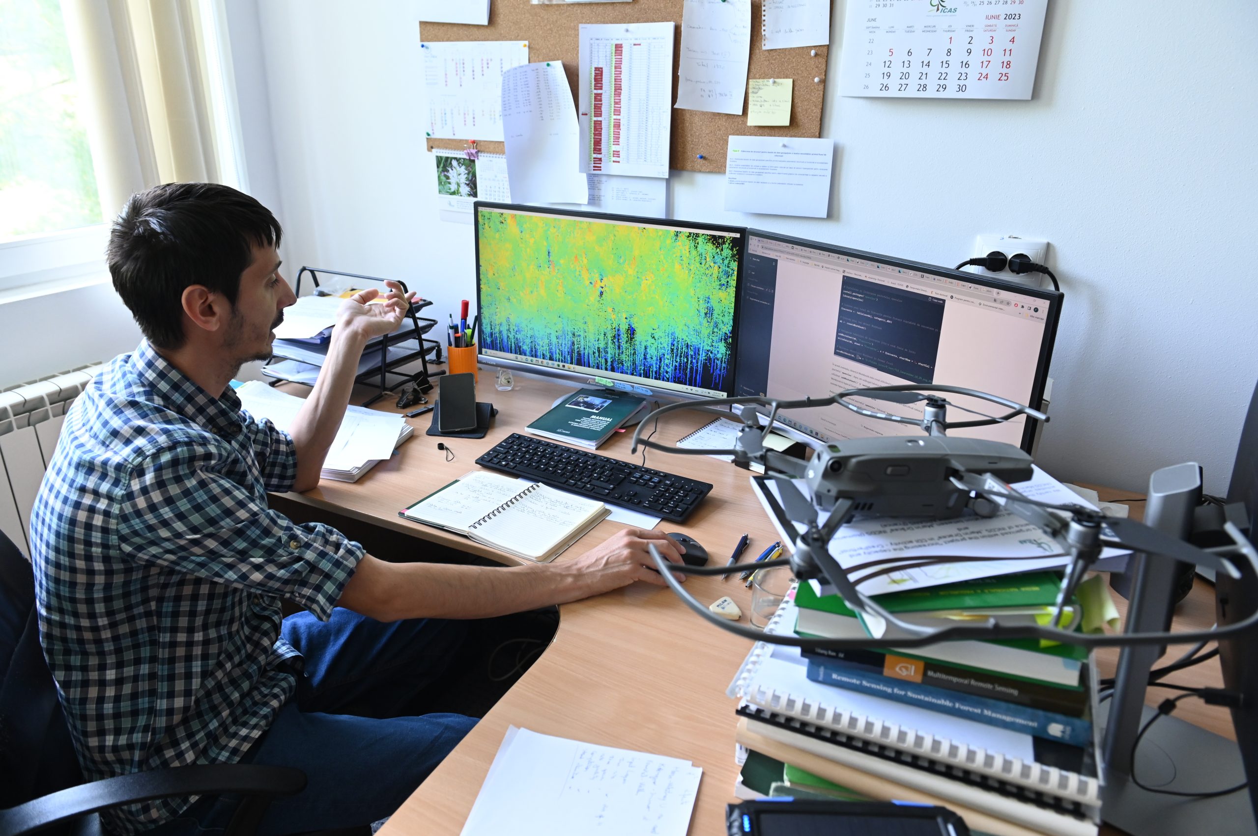
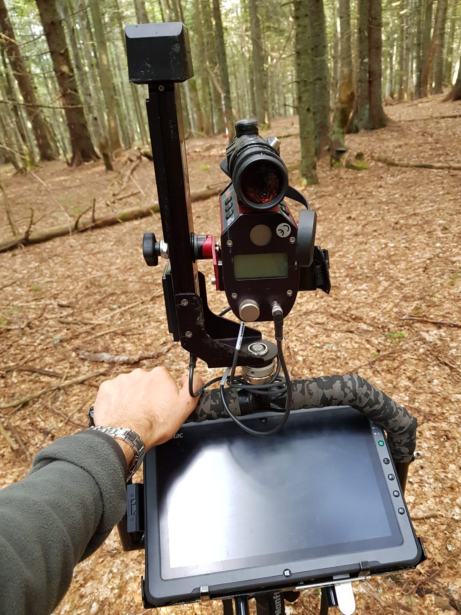
Photo gallery